Weather

Spring Weather Could Turn Stormy

Despite months of cool to downright-frigid weather, it doesn’t look like farmers in the Midwest will see a reprieve anytime soon. March looks to be a chilly month to kick off planting, and parts of the Midwest will not see above-normal temperatures until May. Many states saw record-setting cold temperatures in January and February with some areas receiving in excess of 40" of snow this winter. “This pattern tilts the odds toward colder-than-average weather temperatures overall for the months ahead,” says Laura Edwards, South Dakota State University Extension state climatologist of the National Oceanic Atmospheric Administration. She says spring could bring flooding to South Dakota and possibly other nearby states, too. March forecasts mean farmers will kick-off the season with some unexpected storms, cooler weather and other less-than-favorable conditions. “A very busy pattern looks to continue at least for the foreseeable future,” explains Michael Clark, the co-owner and meteorologist in charge of BAMWX. “We [have] a couple of bigger systems [in] mid-March where we have research even strongly suggesting tornado outbreaks.” He says this forecast for the Midwest all goes back to what’s going on in the northern Pacific Ocean where there’s a barrage of storms. “I look for this active pattern to be around at least to the end of March,” Clark says. “Right now, it’s probably every three to six days there will be a storm.” Those living in the Ohio Valley and Tennessee Valley should keep a sharp eye out for severe weather. “Western Indian Ocean activity correlates strongly to the pattern here in the U.S.,” Clark says. “Not only does it favor severe weather but it favors violent tornado outbreaks, and I don’t use that term lightly,” he notes. “From the southern Ohio Valley and Tennessee Valley to the deep South, the first two weeks of March and the third week of March, even, can really feature some pretty strong storms that are capable of a couple severe weather outbreaks,” he adds. If you’re located in the areas Clark predicts will see some severe weather early this spring, take the time to study your disaster preparedness plans. Review them with your family as well to help make sure everyone stays safe.
Read more...

Crop Insurance Deadline Extended Due To Delayed Harvest

Farmers across the country have struggled with delayed harvest. This week USDA announced the Risk Management Agency (RMA) will provide flexibility for farmers who have been unable to complete harvest prior to December 10, the end date for insurance policies covering most spring-planted crops like including corn and soybeans. Sen. John Hoeven ( X – N.D.), chairman of the Senate Agriculture Appropriations Committee and a member of the Senate Agriculture Committee spoke with Agriculture Secretary Sonny Perdue last month and then sent a letter to the RMA, “urging them to issue guidance to farmers, insurance companies and loss adjustors on properly processing delayed crops and filing claims as harvest continues past the deadline.” “Our farmers need to know that their insurance policies will cover them when facing long delays in harvest,” said Hoeven. “We appreciate Secretary Perdue, Under Secretary (Bill) Northey and RMA Administrator (Martin) Barbre for working with us to issue this guidance prior to the December 10th deadline. Doing so provides much-needed certainty for our agriculture producers as they work through bad weather and difficult conditions to bring this year’s crop out of the field.” North Dakota is one of many states where farmers have abandoned harvest for the time being due to excessive moisture and snowy conditions. Hoeven’s office says that at the end of November there were 1 million acres of corn and 500,000 acres of soybeans left unharvested in North Dakota alone. “I appreciate Chairman Hoeven’s focus on the needs of our farmers and his efforts to get this guidance to them so they can continue to farm even after bad weather hurts their operations,” said USDA Farm Production and Conservation Under Secretary Bill Northey. Under RMA’s guidance, approved insurance providers may allow additional time to harvest when the following conditions are met: Farmers give timely notice of loss to their crop insurance agent; The approved insurance provider determines and documents that the delay in harvest was due to an insured cause of loss; Farmers demonstrate that harvest was not possible due to insured causes; and The delay in harvest was not due to a lack of sufficient equipment or manpower to harvest the crop by the end of the insurance period.
Read more...

Drier Weather Aids U.S. Harvests; Rains Boost South American Crops

Most of the wettest areas of the Midwest were dry during the weekend and harvesting of corn and soybeans advanced. There were some damaging winds that ushered in the drier weather and some areas did get some light showers to slow progress. Most rains once again focused on the southeastern Plains this past weekend, especially central and eastern Oklahoma, and central and eastern Texas. Rains also spread across the northern Delta, and northeastern and southeastern Midwest. The active showers in the northern Delta and northeastern Midwest slowed corn and soybean harvesting a bit, while additional showers in the southeastern Plains maintained some wetness concerns, according to Radiant Solutions LLC. Dry weather in the central and western Midwest and northeastern Plains allowed corn and soybean harvesting and remaining wheat planting to progress well, Don Keeney, senior meteorologist at Radiant Solutions, said in a note to clients Monday. Showers should remain very limited in these areas early this week, allowing fieldwork to continue to progress well. Light showers should build across the Plains and into the western Midwest midweek, before pushing into the central and southeastern Midwest late week. Those showers will slow fieldwork a bit, although no major set-backs are expected, Keeney said. The biggest planting and harvesting problems will be later this week as remnants of Hurricane Willa move out of Mexico and into central Texas before continuing east into the Carolinas by late week and up into the Northeast by the weekend. In Brazil, rains increased across northern areas this past weekend, favoring western and eastern Mato Grosso, northern Goias, northern Minas Gerais, and southern Bahia, Keeney said. Rains are expected to spread across much of Brazil this week, with the heaviest amounts expected across central Brazil. The rain will continue to improve moisture for corn and soybeans development from eastern Mato Grosso to northern Minas Gerais, and into parts of western Mato Grosso do Sul. However, the heavier rains will likely increase wetness concerns again in eastern Mato Grosso do Sul, western Sao Paulo, and western Parana. In Argentina, rain also increased across southwestern areas, especially western Buenos Aires and La Pampa, which improved moisture for corn and soybean germination during the weekend, Keeney said. Rains this week will further improve moisture for crops in central and northern Cordoba, and central and northern Santa Fe. Find more global weather highlights at Pro Farmer.
Read more...

Mother Nature Responsible For Harvest Delays In Much Of The Midwest

On Monday, USDA reported 26% of the nation’s corn had been harvested. While that’s nearly 10% more than the five-year average the same week, harvest pace is likely to slow this week as much of the Corn Belt is receiving rain and even snow. According to Iowa Storm Chasing Network, several inches of rain are expected in Iowa through Thursday and into next week. By Monday morning, forecasts show Iowa will receive more than 5” of rainfall. Areas of Nebraska and Iowa are already seeing flooding. Eastern Iowa and western Illinois have been dealing with heavy rainfall the past 10 days as well. Southern Wisconsin and northern Illinois can also expect severe thunderstorms, hail and 60 mph winds into Wednesday night, according to the National Weather Service. Producers in the Dakotas are dealing with snow.
Read more...

Idaho Wildfire Burns 100,000 Acres, Displaces Thousands of Cattle

A wildfire in Idaho has burned nearly 100,000 acres in less than four days, killing some cattle and forcing thousands more off summer pasture. The Grassy Ridge Fire started on July 26 around 4 pm MST following a lightning strike between Dubois and St. Anthony. Starting out the fire was at 4,400 acres on Friday morning before tripling in acreage Friday night. The fire soon spread reaching approximately 60,000 acres on Saturday morning. As the fire grew it headed near Dubois, forcing the town of approximately 600 people to be evacuated on Saturday. The evacuation was eventually lifted on Sunday morning when the fire was contained in the area. According to the Incident Information System, a government interagency website for fire reports, indicates that 103,935 acres of land have burned as of 8 am MST on Monday with approximately 20% containment. The fire is primarily on Bureau of Land Management (BLM) and state land. Reports on the website show 2,500 to 3,000 cattle have been gathered in the area and moved to safety. However, early reports indicated up to 100 cattle had died because of the Grassy Ridge Fire. A spokesperson with BLM has since said early reports might have been a too high. “Last night, with the way the fire was moving, we had a major effort to get ranchers in — all the cattle owners in to load up their cows and get them to a safer location,” BLM spokeswoman Kelsey Griffee told East Idaho News on July 29. “At this point, we don’t have confirmation on how many were lost, but it’s looking a lot better than we originally thought.” The Grassy Ridge Fire has a fuel load consisting of sagebrush, native short grass prairie and. Weather concerns for the impacted area is low humidity at 10% and high temperatures. Officials expect conditions to be “hotter and drier” heading into Tuesday. There are 191 personnel on the scene helping fight the fire with three fire crews, 15 fire engines, five bulldozers, six water tenders and three helicopters. In the West there are a number of large fires with 98 total fire reported by the National Interagency Fire Center. Those fires have burned more than 1.2 million acres. Three other fires are near the Grassy Ridge Fire in terms of size: Goose Creek Fire, 100,000 acres along the Nevada-Utah border, 15% containment Spring Creek Fire, 108,045 acres near in southern Colorado, 91% containment Carr Fire, 98,724 acres in northern California, 20% containment The wildfire in California has turned deadly with six people being killed, including two firefighters.
Read more...

24 Million Pounds of Pork Lost At JBS Marshalltown Plant After Tornado

Iowa residents and businesses are still cleaning up after tornados last week left severe damage in it’s wake. Farmers were especially concerned with damage to JBS’s Marshalltown facility that forced the plant to close for three days and Vermeer’s hay equipment facility. The Marshalltown facility reopened Monday with a revised schedule, as seen on their Facebook page. Tuesday’s shifts would also have changes. As the cleanup continues, damage estimates are also rolling in. At the JBS facility, more than 24 million pounds of pork will have to be disposed of, after damage to the distribution center and processing line. The Marshalltown Times Republican says winds tore out insulation and panels on the east and west sides of the building. The freezer in the distribution center was damaged. Trailers and rail cars were also flipped in the storm. Despite the challenges, Iowa Pork Producer Association president Pat McGonegle told KCRG-TV that JBS worked quickly with local producers on rerouting pig shipments to other processing plants. (Source: KCRG-TV) Local leaders say initially were some concern if the city landfill would be able to handle that much waste product, as well as all the other cleanup trash. This large volume of pork would equal about half of the landfill’s yearly intake. Meanwhile, JBS employees, Iowa Select Farms and Iowa Pork Producers Association teamed up to offer free hot meals for the Marshalltown community at the town’s YMCA parking lot. Grilled hot dogs and burgers helped re-fuel local residents, some who said they haven’t had meat since the storm, reports KWWL. The JBS Marshalltown pork processing facility, distribution center and warehouse provides fresh, quality pork products to domestic and international customers under the brands Swift Premium All Natural Pork, Swift Premium Fresh Pork and La Herencia. The plant employs more than 2,200 people and partners with more than 500 pig farmers.
Read more...

2018 Cotton Contracts Soar To 90 Cents

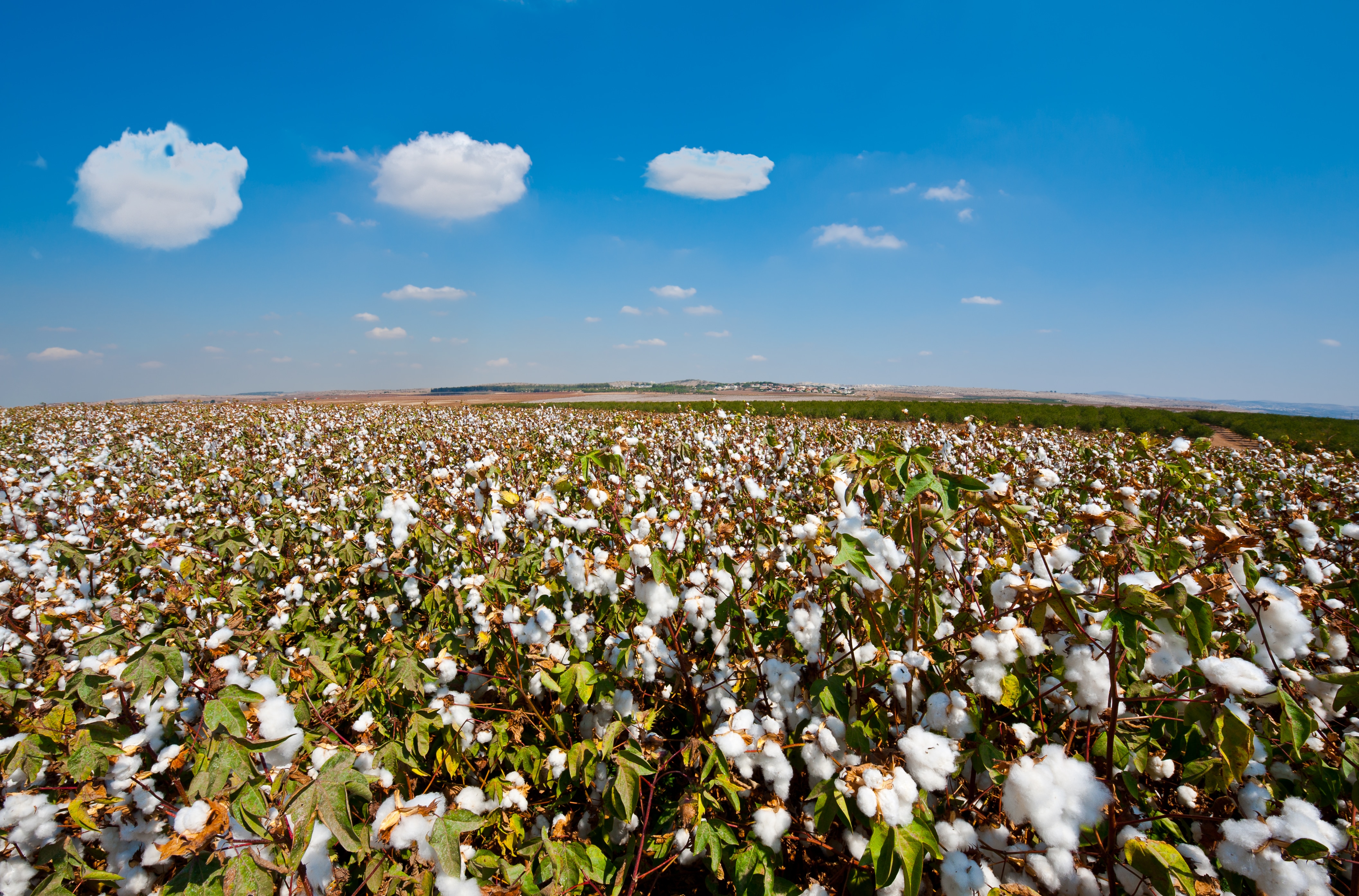
The cotton futures market jumped limit up during Tuesday's trading session with December cotton trading above 90 cents. Cotton has been on a steady climb since last October following harvest and quality challenges. Since mid-May, the prices have spiked nearly 11 cents per pound. Last week, the cotton adjusted world price it its highest mark since 2012. However, weather is playing a role in the price action due to scorching temperatures and lack of rain in the southern Plains. This comes during a time when growers in the Southeast are battling through soggy fields. "I don't even know when we will get back in the fields. I've heard everything from [rain tallying] five inches around my area of rain up to 10 plus inches in other areas," said Michael Hancock, a farmer from Doerun, Georgia. Strong demand in the face of steady to lower world production is helping prop up prices. Analysts say China is selling off some reserves which props up price as well. "Internationally, cotton futures soared to limit up [Monday] night," said Ashley Arrington, founder of AgriAuthority. "We know China has a large reserve of cotton and they put out a certain amount that they are going to sell. The last four auctions have gone very well and have been sell outs. [It's] propping up the idea even further of the great global demand for quality cotton."
Read more...

Kansas, Oklahoma Wheat Crops Struggling to Survive

It's a struggling wheat crop in the Plains adding to the anxiety of weak prices for Kansas wheat farmers. "We've had a number of conditions on our wheat crop this year that's been difficult for it to get through," said Justin Knopf, a farmer in Saline County, Kansas. The Kansas farmer watches wheat get put to the test every year, but 2018 is pushing wheat's limits. "It's a resilient crop, but there are a lot of things outside of our control that's adding to the stress of raising a profitable crop this year," said Knopf. U.S. Department of Agriculture's (USDA) latest crop progress report is painting a grim picture for Kansas wheat this year with 13 percent rated good to excellent, and 44 percent is considered poor to very poor. Nationally, it's the second worst crop since records began in 1986. The weather unleashed another round of possibly fatal weather last weekend, when a freeze blanketed the state. Below-freezing temperatures also hit Kansas in early April, but Knopf thinks that freeze wasn't detrimental to his crop. "Easter weekend 2007 we had snow and then freezing temperatures for about four or five nights, and we lost our entire wheat crop that year," Knopf remembered. "Our field average that year was under 10 bushels per acre." Wheat specialists are looking to determine how much damage is out there, but immaturity in central and northern Kansas is a key factor in protecting the crop from extreme cold. The freezing temperatures gripped some areas harder than others, and maturity of the crop varied. "There were parts of the state- like Hill City in northwest Kansas- where we measured five or six degrees Fahrenheit," said Romulo Lollato, Kansas State Wheat and Forages Extension Specialist. "In other parts of the state, like south central Kansas where the crop is a little bit further along than in northwest Kansas, we measured 17 to 19 Fahrenheit or so." Lollato says while the extent of the damage is still being determined, the father south you travel in the state, the further along the crop is right now. That's why he thinks the southeast portion of the state is at the highest risk of injury. "We were below that 24 [degrees] threshold for that part of the state for about six hours or so," said Lollato. "I think that can hurt"”we can see some of the primary tillers get slaughtered off in that part of the state." The bigger risk of damage may sit in Oklahoma right now, as concerned farmers cancelled new crop wheat contracts in fear that a portion of the crop is lost. "One percent of Oklahoma was headed already, more of it was in the boot stage where we'd look at 24 degrees for two hours as being a critical temperature," said Suderman. "Temperatures dropped down in the low 20s in many of those areas of Oklahoma, so we believe there was quite a bit of damage in Oklahoma." Oklahoma State's small grains specialist David Marburger says scars are starting to show up. "We are starting now to see some injury symptoms, such as leaf tip burning," he said. He says it's still too early for most farmers to depict the extent of damage of the recent freeze in Oklahoma. "It's the hardest thing to do, but it's best to wait a week - if it's still cool, maybe a little bit longer than a week - and then go out and assess what type of injury did we get on this crop," Marburger said. It's a delayed crop that's already struggling as drought worsens across both Oklahoma and Kansas. The latest U.S. drought monitor shows while 58 percent of Oklahoma is seeing drought, exceptional drought now covers 18 percent of the state. In Kansas, more than 97 percent is covered with dry conditions and nearly 60 percent is considered severe or worse. Knopf hasn't seen rain since fall. "After those rains finished in October, it stopped raining ever since," he said. "We've had the driest winter on record for much of Kansas." It's that disappointing story playing out for wheat growers across the plains. "The drought has still taken away a lot of the yield potential, and that's going to hurt the crops ability to come back from this spring freeze damage," said Suderman. "We're going to be in a real dicey situation as we head into warmer temperatures - we're going to use up that small amount of soil moisture we have at the surface pretty rapidly," said Knopf. "The ongoing drought is real significant as we move further into spring." If rains swept the state today, Lollato says some of the state's crop has already been damaged enough that moisture would save the crop. "If we have some rain soon, we can still have a decent crop, but in parts of the state - like southwest Kansas"”I believe we already hurt our yield potential," he said. It's that potential also lost in parts of Oklahoma. "You've got a third of the state that's in despicable, desperate conditions," said Kim Anderson, Oklahoma State University Grain Marketing Specialist. "They're looking at yields 10 bushels per acre." Anderson says if there's a silver lining in all of this, it's the possible protein of the wheat this year. "I think quality is more important than yield this year," said Anderson. "You're going to be paid on the bushels produced; however, if we produce a crop with relatively low protein and low test weight, we're going to have prices below $4. If we can average with high protein and test weight, we're going to have prices up around $5 to $5.25 because the market needs the wheat." However, Lollato warns that if the market is flooded with high-protein wheat, he questions if producers will actually get paid for that protein. "The last two years they were because the majority of the state had low protein, so whoever managed for that protein were getting a premium," he said. "If everyone has a high protein, may be god for the market, but not for the producers." Whether it's from yield or protein, wheat producers like Knopf say they need higher prices than what they're faced with today. "Right now we're hovering right around break even prices, going on both sides of that," he said. Suderman says the recipe for higher wheat prices would be with two key events. "One would be a problem in another major wheat producing area of the world that competes with our milling wheat here in the Plains," he said. "The other factor would be the continued strength in corn. The two feed off each other so if we have strength in corn, that could allow world wheat prices to drift higher, as well" As wheat prices struggle to reach break-even, it's starting to look like a disappointing finish to the final chapter of what's been a trying and challenging year.
Read more...

Winter Storm Warnings in 6 States; Severe Thunderstorms In Midwest

It might be spring on the calendar, but a major winter storm system, bringing snow and blizzard conditions is rolling through parts of the Plains and the Midwest Friday through the weekend. Snow is falling over the High Plains from the Dakotas to eastern Colorado Friday. Several areas report blizzard conditions in eastern Colorado, western Kansas and western Nebraska. Weather.com reports almost 10" of snow has fallen in Rapid City, S.D., and Great Falls, Mont. Estimates of 20" to 30" of snow was reported in Bridger Range, north of Bozeman, Mont. Winds that are pushing wildfires in Oklahoma, are also to blame for the blizzard conditions and will make snow drift. Gusts of more than 40 mph have been recorded Friday morning in southeast Wyoming, eastern Colorado and western Nebraska. Severe Weather Threat Continues Over the Weekend Blizzard warnings are in effect from northeast Colorado to South Dakota and southwest Minnesota, the National Weather Service says. Winter storm warnings, advisories and watches are in effect in the surrounding areas. As the system moves east, threats of heavy snow will shift to the Upper Midwest and Great Lakes on Saturday. Across the Southern Plains, a pronounced dryline and cold front will develop numerous thunderstorms over the weekend. Threats of damaging winds, heavy rain and minor flooding are possible. Wildfires are also a threat. Rain and flooding risk extends and increases in the Lower Mississippi Valley.
Read more...

Isolated Tornadoes Loom Across Central, Southern U.S.

AccuWeather reports an outbreak of severe thunderstorms, including the potential for a few tornadoes, is anticipated from portions of the central and southern Plains to the Mississippi, Ohio and Tennessee valleys spanning Friday and Saturday. The eruption of thunderstorms will be inspired by a strong temperature contrast, fueled by daytime heating and a surge of Gulf of Mexico moisture and enhanced by strong winds and dry air aloft. The same storm bringing the ingredients for severe weather together will also produce heavy snow and blizzard conditions in part of the north-central United States. More than 22 million people will be at risk for severe weather on Friday alone. This day, the potential for damaging weather conditions will extend from near the Nebraska and Iowa border, southward to central Texas and eastward to Louisiana, Arkansas, Missouri and western Illinois. During Friday, major cities at risk for violent storms and potential damage include Des Moines, Iowa; Kansas City and Springfield, Missouri; Fort Smith, Arkansas; and Dallas, Austin and San Antonio, Texas. The storms will pick up forward speed on Friday night as the roll through Moline, Illinois; St. Louis; Little Rock, Arkansas; Memphis, Tennessee; Shreveport and Alexandria, Louisiana; and Houston. The storms may bring the full spectrum of severe weather ranging from high winds, large hail, flash flooding, frequent lightning strikes and perhaps a tornado. On Saturday, the severe weather setup is likely to be complex in that clouds and rain from Friday night's thunderstorms may race eastward and limit severe weather in parts of the Midwest and South, according to AccuWeather Senior Meteorologist Kristina Pydynowski. "Two or three separate areas of severe weather may evolve on Saturday," Pydynowski said. "Where the sun is out long enough to allow some heating, ahead of the push of cooler air is where the greatest risk of severe thunderstorms will be." A severe thunderstorm and flooding rainfall are possible in Peoria, Illinois; Indianapolis; Louisville; Kentucky; Jackson, Mississippi; New Orleans; and Mobile, Alabama; on Saturday. One area may focus near and north of the Ohio River, while a second area is likely farther south, perhaps from Tennessee to the Gulf coast. The risk of heavy, gusty and locally severe thunderstorms is likely to continue farther to the east on Sunday. People from the eastern part of the Ohio Valley to the central and southern Appalachians and Piedmont should be on the lookout for rapidly changing weather conditions on Sunday. Downpours and gusty storms may affect the major airport hubs of Cincinnati, Pittsburgh, Nashville, Atlanta and Charlotte, North Carolina, to close out the weekend. The NASCAR race at Bristol Motor Speedway, Tennessee, may be threatened by drenching downpours and gusty thunderstorms on Sunday afternoon. A sweep of much cooler air will end the severe weather threat from west to east spanning Saturday to Monday. Persistent well below-average temperatures has been a factor in lower-than-average tornadoes so far this year. For example, in areas from Oklahoma City to St. Louis and Little Rock, temperatures have averaged 10 to 14 degrees below normal for April thus far. These areas lie within the heart of Tornado Alley. As of April 10, based on preliminary reports, there have been 47 tornadoes this month, compared to a recent three-year average of 174 confirmed tornadoes, according to the National Oceanic and Atmospheric Administration. The actual number of tornadoes through April 10 this year is likely to be less, once research has been completed. During April 2017, when temperatures averaged above normal over much of the region, there were 211 confirmed tornadoes across the nation. AccuWeather Storm Warning Meteorologists are estimating that between two and four dozen tornadoes may be reported with this multiple-day event. Most of the storms capable of producing tornadoes are likely to be from late Friday afternoon to Friday evening.
Read more...